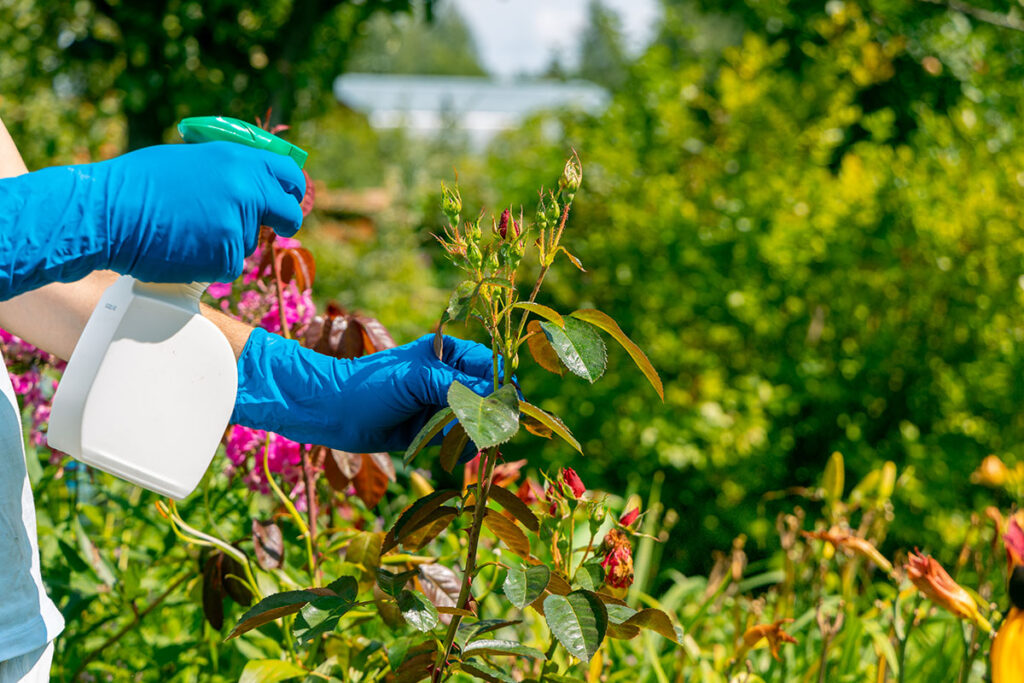
Satellite Based Monitoring
At Royal Agro Mart Pvt. Ltd., we integrate cutting-edge satellite imaging and AI-powered analytics to empower farmers, agri-businesses, and policymakers with real-time insights for sustainable and profitable farming.
- Imaging
- Crop Health Assessment
- Manitoring Growth
- Stages
- Detection of Stress
- Factors
- Spatial Analysis and
- Mapping
- Yield Estimation
- Decision Support Systems

Imaging
Satellites equipped with optical sensors, multispectral cameras, or synthetic aperture radar (SAR) capture images of agricultural areas from space. These images provide spatial data on crop fields, vegetation cover, and land use patterns.

Crop Health Assessment
Satellite imagery allows for the assessment of crop health indicators such as vegetation vigor, biomass accumulation, and chlorophyll content. By analyzing spectral reflectance patterns in different wavelengths, researchers can derive vegetation indices like the Normalized Difference Vegetation Index (NDVI) or Enhanced Vegetation Index (EVI), which provide quantitative measures of crop health and photosynthetic activity.

Monitoring Growth Stages
Satellite imagery can track the phenological development of crops throughout the growing season. Changes in crop color, canopy structure, and growth patterns observed in satellite images provide insights into crop growth stages, including emergence, vegetative growth, flowering, and maturity. This information helps farmers time agricultural practices such as planting, irrigation, fertilization, and harvest.

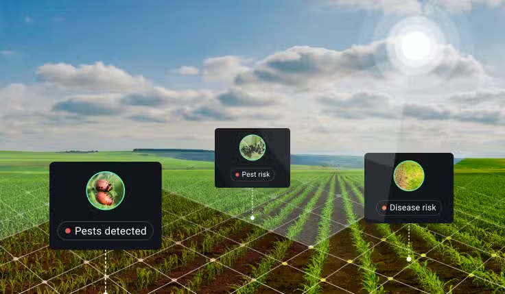
Detection of Stress Factors
Satellite monitoring can detect stress factors affecting crops, such as drought, nutrient deficiencies, pests, diseases, and environmental pollution. Anomalies in vegetation indices or changes in crop reflectance patterns indicate areas of stress or poor crop performance, prompting further investigation and targeted management interventions.
Spatial Analysis and Mapping
Satellite imagery enables spatial analysis and mapping of crop conditions at different scales, from individual fields to regional or global extents. Geographic Information Systems (GIS) and remote sensing software are used to process and analyze satellite data, generate thematic maps, and quantify spatial patterns of crop health, yield potential, and land cover changes.

Yield Estimation
Satellite monitoring contributes to yield estimation and forecasting by providing input data for crop growth models and statistical algorithms. Integration of satellite-derived variables, such as vegetation indices,
weather data, soil characteristics, and management practices, enables the prediction of crop yields at various spatial and
temporal scales.

Decision Support Systems
Satellite-based crop monitoring systems provide decision support tools and early warning systems for farmers and stakeholders. Timely information on crop conditions, risks, and opportunities facilitates adaptive management, resource allocation, and mitigation strategies to optimize crop productivity, minimize losses, and enhance resilience to environmental variability.
Satellite-Based Farming Mobile
A satellite-based farming mobile application leverages satellite imagery and remote sensing technology to provide farmers with valuable insights and tools for precision agriculture and crop management.
Here’s an overview of features and functionalities commonly found in such applications:
1.Field Monitoring and Mapping: Farmers can use the mobile app to access satellite imagery of their fields, providing high-resolution maps and aerial views. These maps help farmers monitor crop growth, detect variability within fields, and identify areas of concern such as pest infestations, diseases, or nutrient deficiencies.
2.Crop Health Assessment: Satellite-based farming apps often incorporate vegetation indices derived from satellite imagery, such as NDVI (Normalized Difference Vegetation Index), EVI (Enhanced Vegetation Index), or NDRE (Normalized Difference Red Edge). These indices quantify crop health and vigor, allowing farmers to assess the effectiveness of management practices and make data-driven decisions regarding irrigation, ertilization and pest control. Rovab
3.Yield Prediction and Forecasting: Some applications utilize satellite data and machine learning algorithms to predict crop yields and provide yield forecasts for upcoming seasons. By analyzing historical yield data, weather patterns, and satellite-derived variables, these tools help farmers anticipate harvest outcomes, optimize inputs, and mitigate production risks.
4.Field Scauting and Pest Management: Satellite-based farming apps facilitate field scouting and pest monitoring by enabling farmers to annotate and mark specific locations within their fields. Farmers can record observations of pest pressure, weed infestations, crop diseases, or other agronomic issues directly on the mobile app, allowing for real-time data collection and decision-making.
5.Variable Rate Application (VRA): Some applications support variable rate application of inputs such as fertilizers, pesticides, and irrigation water based on satellite-derived information and field variability maps. By adjusting input rates according to spatial variability within fields, farmers can optimize resource use, minimize environmental impacts, and improve crop yield and quality.
6.Weather Monitoring and Forecasting: Satellite-based farming apps often integrate weather data
and forecasts to provide farmers with up-to-date information on temperature, precipitation, humidity,
wind speed, and other meteorological variables. Timely weather alerts and forecasts help farmers plan field operations, optimize irrigation scheduling, and mitigate weather-related risks. Rovab
7.Data Analytics and Insights: Satellite-based farming apps may offer data analytics and visualization tools to help farmers analyze trends, patterns, and correlations in their agronomic data. By aggregating and summarizing satellite imagery, weather data, soil information, and yield records, these tools provide actionable insights for improving farm management practices and maximizing profitability.
8.Integration with Precision Agriculture Equipment: Some applications support integration with precision agriculture equipment such as GPS-guided tractors, drones, and soil sensors. This integration enables seamless data sharing and collaboration between the mobile app and farm machinery, facilitating precision farming operations and data-driven decision-making in the field.
Satellite vs Drones For The Agri-Sector
Drone-based and satellite-based farming technologies offer distinct advantages and applications, each with its own strengths and limitations. Here’s a comparison of drone-based and satellite-based farming:
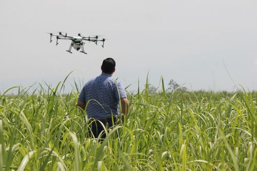
Drone-based Farming:
1.High Spatial Resolution: Drones can capture high-resolution imagery of crops and fields, providing detailed insights into crop health, pest
infestations, and other agronomic factors. This level of detail allows for precise monitoring and targeted interventions.
2.Flexibility and Maneuverability: Drones offer flexibility in flight patterns and can be programmed to fly specific routes over fields, enabling targeted imaging and data collection. They can capture imagery from different angles and altitudes, providing comprehensive coverage offields and overcoming obstacles such as cioud cover.
3.Real-time Monitoring: Drones can provide real-time
Monitoring of crop conditions, allowing farmers to quickly
detect emerging issues such as pest outbreaks or water stress
This timely information enables proactive decision-making and rapid response to agronomic challenges
4.On-demand Data Collection: Drones enable on-demand data
collectior allowingfarmers to capture imagery precisely when needed, such as during critical growth stages or after weather events. This flexibility enhances the timeliness and relevance of the information collected
5.Small Area Coverage: Drones are suitable for monitoring smaller areas or individual fields, making them ideal for intensive crop management, precision, agriculture, and site-specificinterventions
Satellite-based Farming:-
Large Area Coverage: Satellites can capture imagery of vast agricultural landscapes, providing coverage over large areas in a single pass. This capability is well-suited for regional or global monitoring, crop mapping, and large-scale analysis.
Consistent and Regular Imaging Satellites offer consistent Imaging schedules and regular coverage of agricultural regions, allowing for long-term monitoring and trend analysis. This continuity is valuable for assessing seasonal variability, tracking crop growth over time, and detecting long-term brends
Cost-effectiveness: Satellite imagery is generally more cost-effective than drone-based imagery for monitoring large areas. Satellites provide
economies ofscale and can offeracost-effertive solution for monitoring extensive agricultural operations
Weather Independence: Satellites are not affected by weather conditions such as cloud cover fog, or rain, ensuring consistent data acquisition regardless of atmospheric conditions This weather independence is advantagenus for obtaining reliable imagery in regions prone to cloud cover or inclement weather
Global Coverage: Satellites offer global coverage, making them suitable
for monitoring agricultural regions in remote or inaccessible areas where ground-based monitoring may be challenging. This global perspective enables broad-scale analysis and monitoring of agricultural trends on a regional or global scale.
Yield Prediction: Yieid prediction involves estimating the expected quantity of crops or agricultural products that will be harvested from
a given area under specific growing conditions. Accurate yield prediction is crucial for farmers, agribusinesses, policymakers, and other stakeholders to make informed decisions regarding crop planning resource allocation, market forecasting, and food security
Data Collection: Vield prediction relies on various types of data, including historical yield records, weather data, soil information, crop management practices, and satellite imagery.
Crop Growth Models: Crop growth models simulate the growth and development of crops over time based on inputs such as weather, soil, crop type, and management practices
Remote Sensing: Remote sensing technologies, such as satellite Imagery and aerial drones, providevaluable spatial data for yield prediction.
Machine Learning and Data Analytics: Machine leaming algorithms and data analytics techniques can analyze large datasets to identify patterrs, trends, and
correlations that influence crop yields
Weather Forecasting: Weather conditions play a significant role in crop growth and yield formation. Integration of weather forecasts into yield prediction models
allows for real-time adjustments and scenario analysis based on projected weather conditions
Field Surveys and Ground Truthing: Field surveys and ground truthing activities involve collecting in-situ data on crop growth, development, and yield parameters
Expert Knowledge and Experience: Expert knowledge and farmer experience are valuable resources in yield prediction, providing insights into site-specific conditions, crop performance, and management practice
Crop Mapping via Satellite
Crop mapping via satellite involves using satellite imagery and remote sensingtechniques to identify, delineate, and dassify different crop types and land cover classes across agricultural landscapes. This process provides valuable information about the spatial distribution, extent, and characteristics of various crops, facilitating crop monitoring management, and decision-making for farmers, agronomists, and policymakers.Here’s how crop mappingvia satellite is typically conducted: Royab
1, Satellite Data Acquisition: High-resolution satellite images are acquired from Earth observation satellites such as Landsat, Sentinel-2, or commercial satellite platforms. These satellites capture multispectral and/or hyperspectral imagery with different spectral bands, allowing forthe detection of vegetation, soil, water, and other land surface features.
2. Prepracessing and Image Enhancement: The acquired satellite imapes undergo preprocessing steps to correct for atmospheric effects, sensor distortions, and geometric inaccuracies Image enhancement techniques may be applied to improve image quality, enhance contrast, and reduce noise, making it easier to interpret and analyze the imagery
3. Image Classification: Image dassification techniques are employed to categorize pixels within the satellite imagery into different land cover classes, including various crop types,
natural vegetation, bare soil, water bodies, and built-up areas Supervised, unsupervised, or semi-supervised classification algorithms may be used, along with machine leaming and deep learning approaches for automated feature extraction and classification
4. Training Data Collection: In supervised classification methods, training data are collected to train the classification algorithm to recognize specific crop types or land cover dasses. Ground truth data, field observations, historical crop maps, and existing land use/land cover databases may be used to create training samples representative of different crops and land cover categories.